Planning a summer trip to Seattle? Don’t miss this epic day trip to spend some time outdoors among carpets of wildflowers – read on to discover some of the best hikes & things to do in Mount Rainier National Park. There are many hiking trails in Paradise, Longmire, Ohanapecosh, Sunrise, and Carbon/Mowich areas of Mount Rainier National Park.
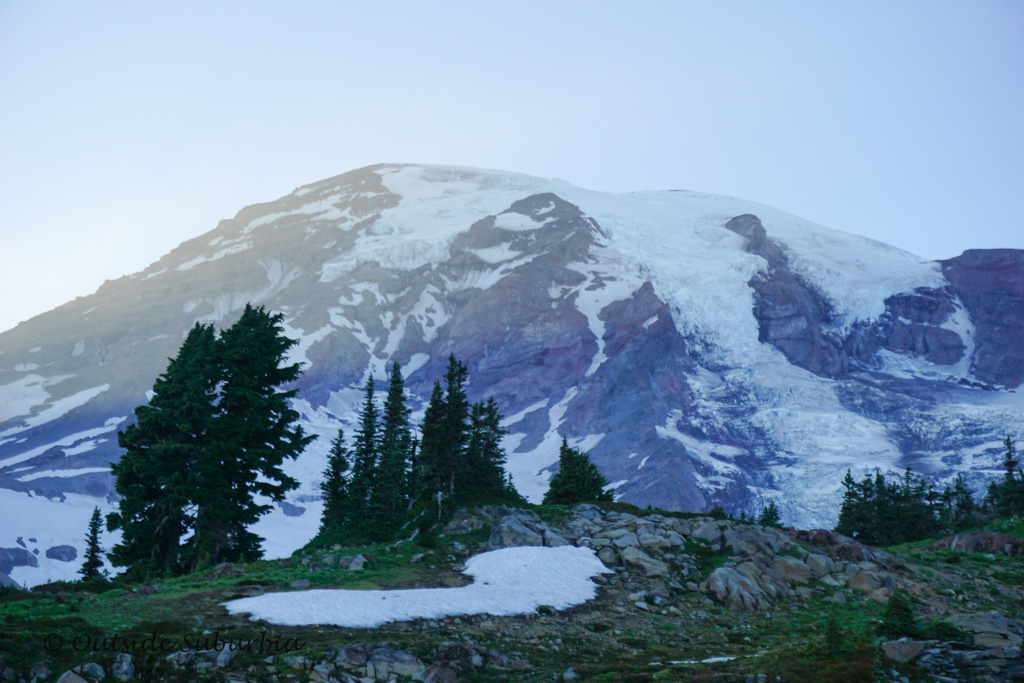
Mount Rainier is Washington’s highest mountain. At 14,411 it is the highest mountain in the Cascade Range and it is the most glaciated peak in the contiguous U.S.A. Covered most of the year in snow, there are 26 major glaciers that spawn five major rivers.
WHAT IS IN THIS POST
Our visit to Mt. Rainier National Park
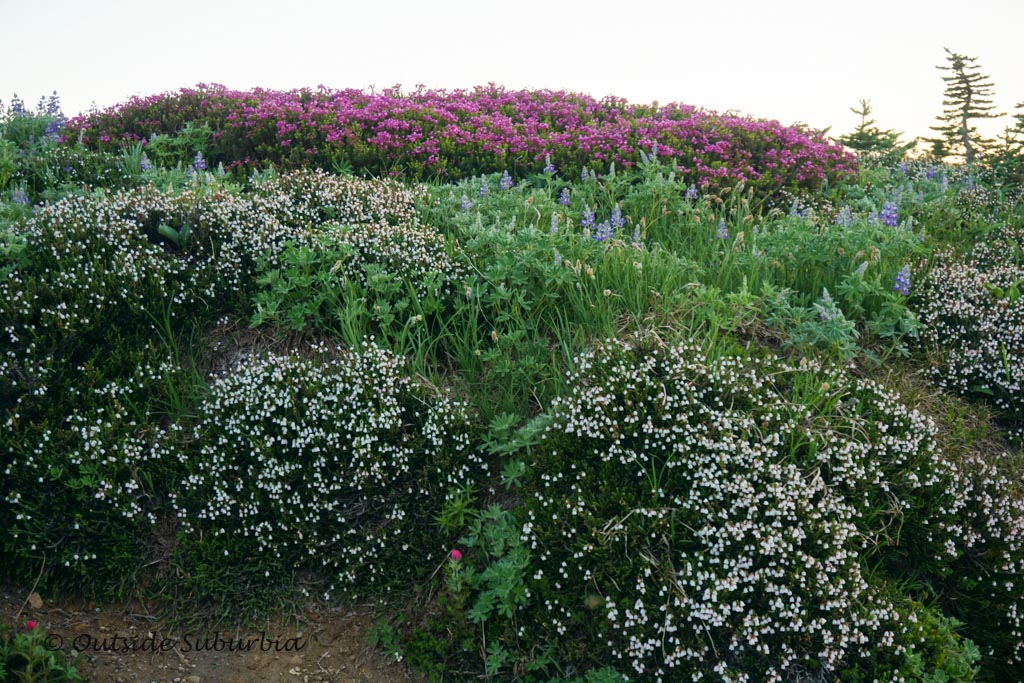
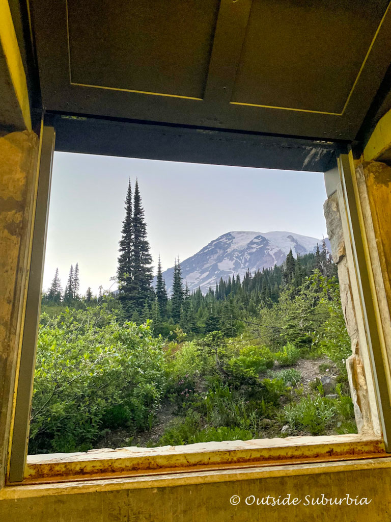
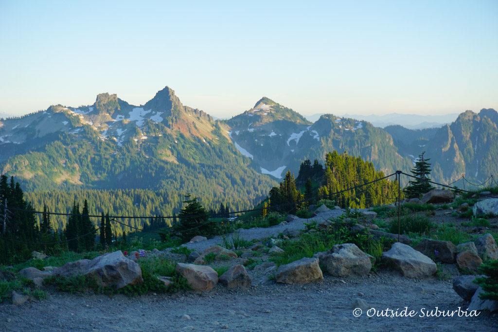
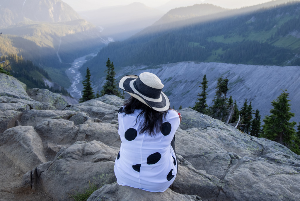
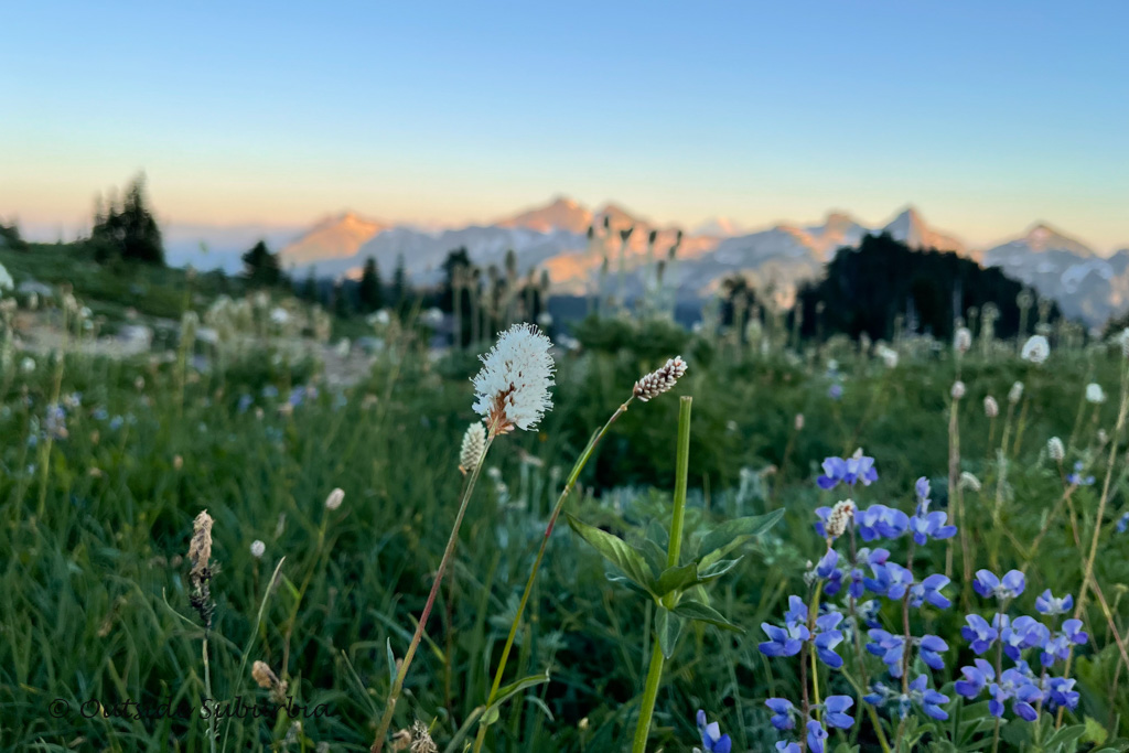
We were lucky to be blessed with a clear day and blue skies. While driving towards the park we could see Mount Rainier dominate the Seattle and Tacoma skylines. Once there we got to enjoy some up-close stunning views of this active and glaciated volcano, and surrounding forests. The best part was the splashes of color in the subalpine wildflower meadows! So many vibrantly colorful flowers!
I knew there would be wildflowers at Mt. Rainier NP, but this was beyond what I had expected to see… Virinda Longmire, one of the pioneers of Mt Rainier trekked to the Pacific Northwest by wagon in 1853 with her husband James Longmire, and their four children. She aptly named this part of Mt.Rainier, Paradise in the summer of 1885 when she saw the wildflowers in the alpine meadows on the slopes of the mountain.
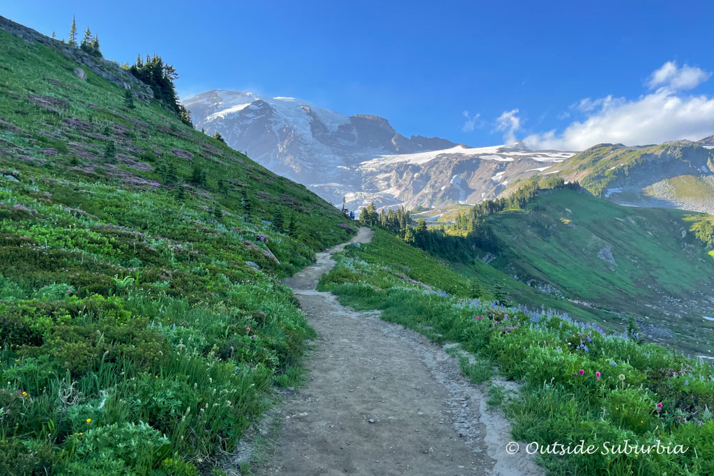
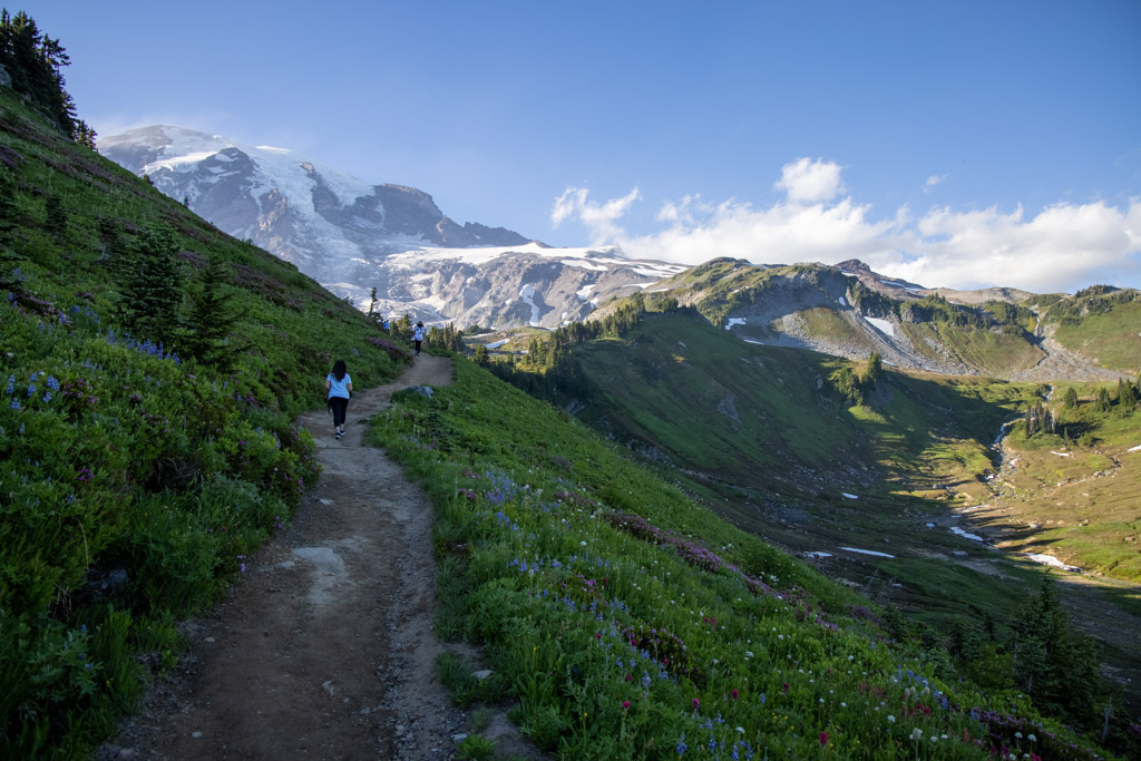
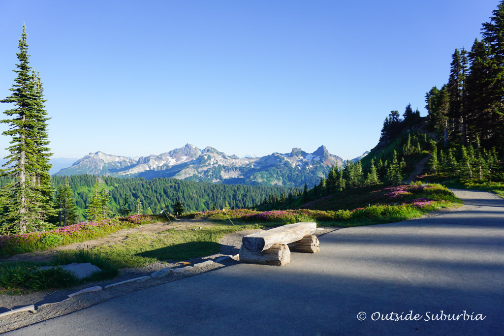
If your schedule allows you time to hike only one trail at Mount Rainier National Park, I recommend the Skyline Trail, especially on a beautiful sunny day. The hike will take you through a variety of terrain ranging from meadows with wildflower displays to snowfields and some glacier parts. You can stop at any point to turn around, I doubt if you will want to!
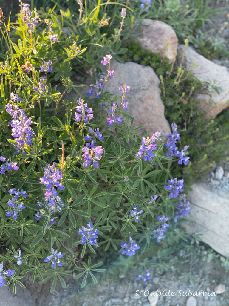
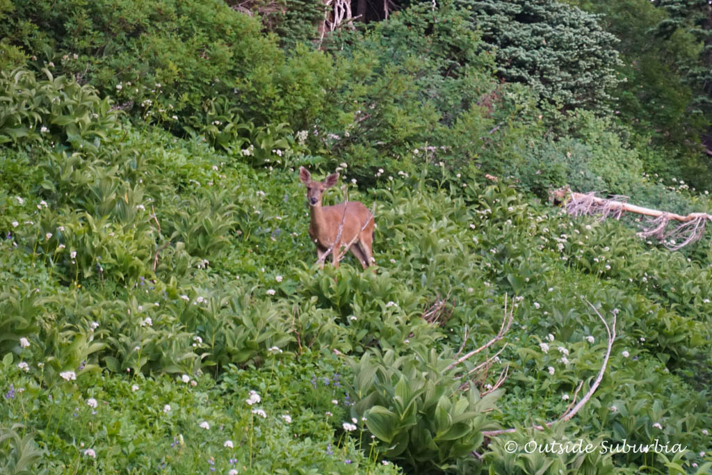
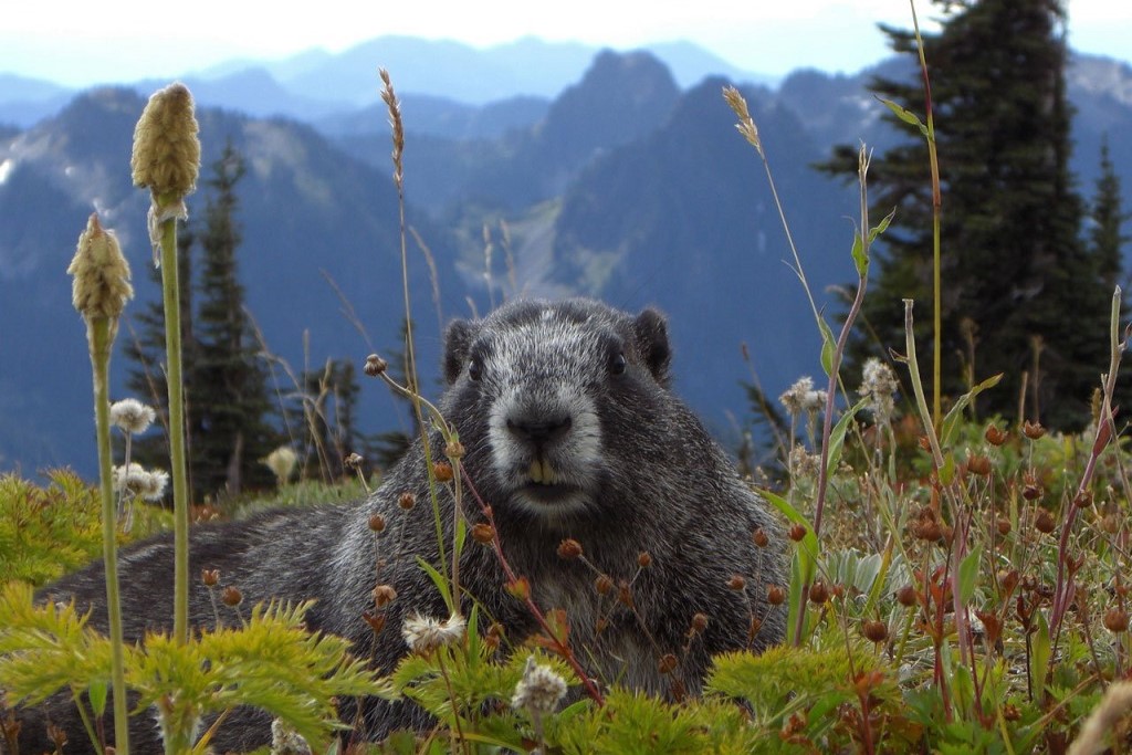
During the summer months, the meadows on the lower slopes that ring the mammoth volcano are filled with wildflowers. You can see lupines, magenta paintbrush, alpine asters and yellow fan-leaf cinquefoil. Keep your eyes peeled for wildlife. I saw a prairie dog scurry past me and a few deer in the distance. There are many clear lakes, hiking trails, and waterfalls to discover at Mt Rainier NP.
A Day trip from Seattle to Mount Rainier National Park
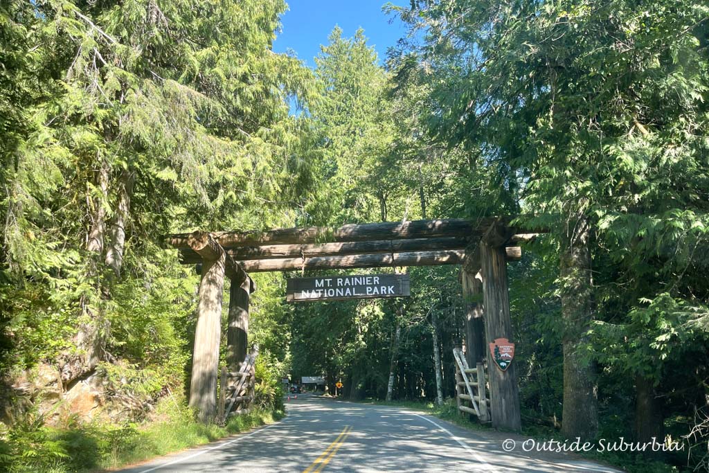
This active volcano and its surrounding national park make for the perfect day trip from Seattle. Mount Rainier National Park is about 100 miles from Seattle depending on which park entrance you chose – you can’t go wrong though with choosing any part of the park, there are lots to do and see all around at Mt Rainier National Park. To help you decide which entrance, here are a few highlights of each:
Paradise is famous for its majestic views and wildflower meadows (during spring and summer) and is home to Paradise Henry N. Jackson Visitor Center.
- Start your trip at the Paradise Jackson Visitor Center to learn more about the park and see the a film about the park.
- Pick up a trail map at the Visitor Center so you can plan your hikes. A first-time visitor may find the intricate maze of trails confusing.
- You can turn around at any point but try to make it to Pan
- For lunch, if you didn’t bring a picnic, stop at the historic Paradise Inn, which was built in 1916. You can see the authentic Native American arts and crafts at the gift shop.
- Time permitting, drive three miles east of Paradise on Steven Canyon road to see Mt. Rainier in the subalpine Reflection Lakes.
If you are visiting in summer, when the snow melts, you can go higher up on Mt. Rainier to Sunrise, which is the highest point that can be reached by vehicle. On clear days, it is possible to see the Emmons glacier and many of the other volcanoes in the Cascade Range.
- Start your visit at the Tipsso Lake where you can seeing what the glaciers created many years ago.
- If you are looking for more hikes in Mt. Rainier, try the Sourdough Ridge Trail. It offers numerous wildflower meadows and breathtaking views of Mt. Rainier, Mt. Baker and Mt. Adams and Glacier Peak.
- Pack a picnic and stop for lunch at the Sunrise Visitor Center and learn more about the park’s history.
- Drive to Sunrise Point, and on the way, look out for the andesite columns on the left that were formed from an ancient Mt. Rainier lava flow.
- Finish your day taking in the sweeping views of the Cascade Range, Sunrise Lake and Mt. Rainier at Sunrise Point.
Mount Rainier National Park is part of the traditional lands of indigenous people who have been here for generations – the Cowlitz, Muckleshoot, Nisqually, Puyallup, Squaxin Island, and Yakama people are the original stewards of this place.
Hiking trails & Best things to do Mt Rainier National Park Map
There is something almost magical about seeing Mount Rainier, especially your first time. This glacier-capped volcano can be seen for hundreds of miles, from Seattle But to see Mt. Rainier up close from hiking trails and overlooks in the park is pretty extraordinary. From many of the trails, you get some amazing views of Mount Rainier. Then there are those wildflowers, lakes, and waterfalls – this part of the park is a paradise, a hiking paradise.
How to Use This Map: Use your fingers or computer mouse to zoom in on the details. Click the tab in the top left-hand corner of the map to view the layers (places and the driving route). You can click the icons on the map to get more information about each point of interest.
If you click the star next to the title of the map, this map will be added to your Google Maps account. To view it on your phone or computer, open Google Maps, click the menu button, go to “Your Places,” click Maps, and you will see this map on the list.
Best Hikes in Mount Rainier National Park
Hiking trails in the Paradise Area
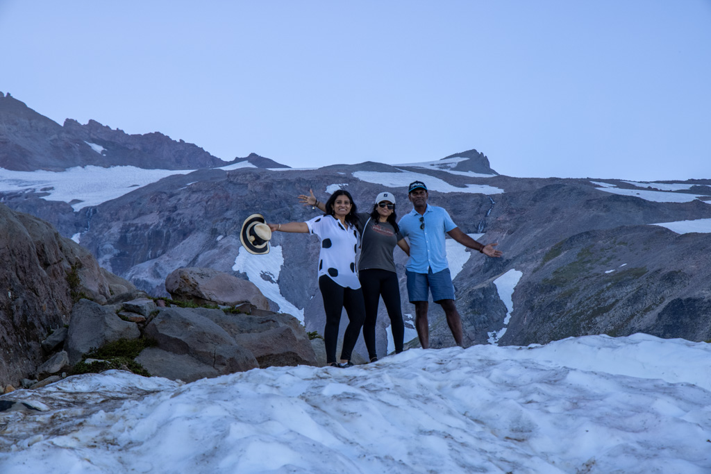
The hikes below focus on the Paradise area of Mt. Rainier where I got to spend a day on the trails during a recent trip with my friends.
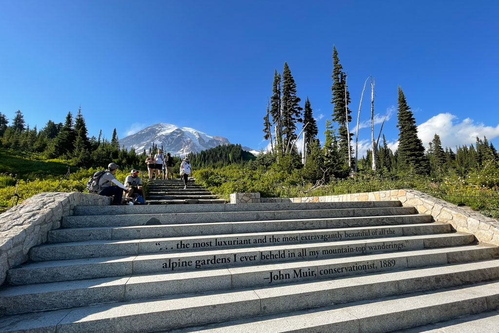
The hike to Panorama Point via the Skyline Trail starts out on stone steps near the Visitor Center. Don’t miss the John Muir quote.
If you like Travel Quotes, you will want to see this post
See a visual story of Mt Rainier hikes
Nisqually Vista Trail, an easy Mount Rainier Hike
Hiking Distance: 1.2 mile loop
Trail Difficulty: Easy
Approx Time Needed: 45 minutes
Trailhead: Starts at the Lower Paradise parking lot
This easy, paved trail offers some of the best views of Mount Rainier and the Nisqually Glacier. It is a great option if you want views of Mount Rainier with minimal effort or if you have little kids hiking with you. There are a few short but steep climbs along the way but this Paradise trail in Mt. Rainier NP is easy to do.

Myrtle Falls
Hiking Distance: 1 mile
Trail Difficulty: Easy
Approx Time Needed: 30 minutes
Trailhead: Starts at the Upper Paradise Parking Lot
If you are looking for one easy-to-do hike in the Paradise area, this is it! It is a paved path the entire way to Myrtle Falls making it a great hike for families with young kids and strollers.
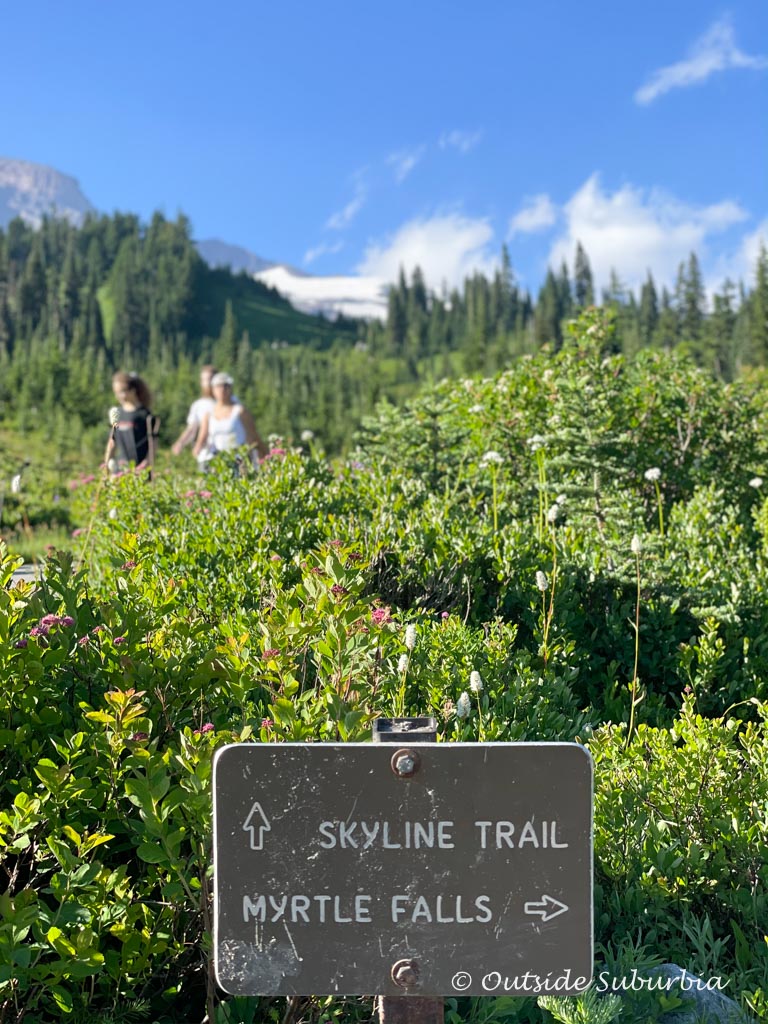
Starting right next to the Paradise Inn, the first part trail is shared by the Skyline Trail. Once you get to Edith Gorge, there are two viewpoints to visit. Take the short but steep spur trail for a view of Myrtle Falls.
Once you are back on the Skyline Trail, turn right and within about 100 feet, you will see a spectacular view of Mount Rainier with Edith Gorge.
Skyline Trail at Mt Rainier
Hiking Distance: 5.4 mile loop
Trail Difficulty: Moderate to Strenuous
Approx Time Needed: 4 to 5 hours
Trailhead: Upper Paradise parking lot
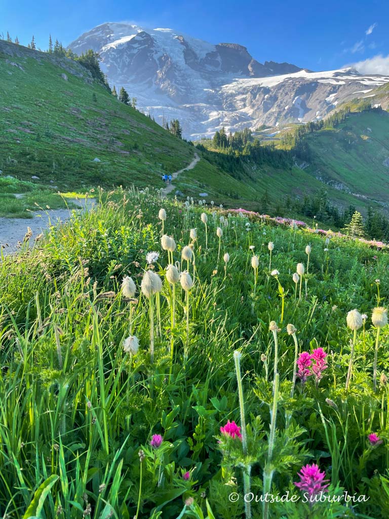
This is one of the BEST HIKES in Mount Rainier! If your schedule allows you time to hike only one trail at Mount Rainier National Park, I highly recommend the Skyline Trail, especially on a sunny day. You will be hiking through a variety of terrain ranging from meadows with wildflower displays to patches of snow, snowfields and views of the glaciers.
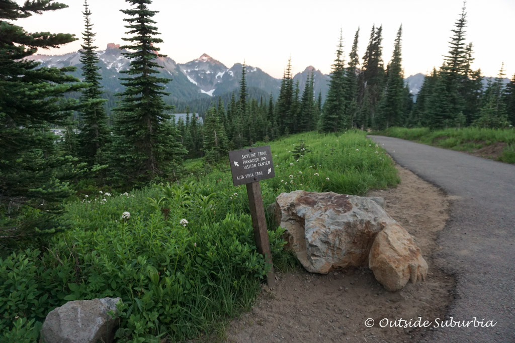
The hike from Paradise to Panorama Point is one of the best things to do at Mount Rainier National Park. During the summer months, people come to experience the wildflower displays for which Paradise is famous. On clear days in addition to views of Mount Rainier and the Nisqually glacier, you can see the rugged Tatoosh Peaks, Mount Adams, all the way to Mount Hood and Saint Helens!
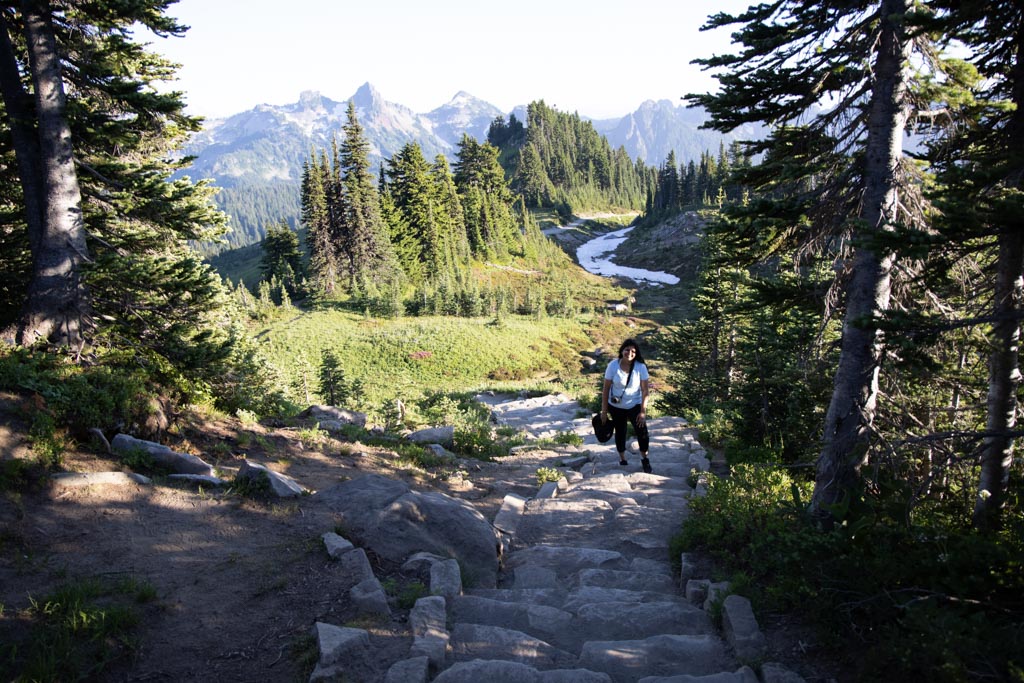
This is where we spent most of our day at Mt. Rainier. The entire hike was beautiful. To be honest, I struggled with the first part of the hike where there was a 900 ft elevation gain in the first mile, but after that things got better. The trail was flat and there were plenty of wildflowers to distract me 🙂
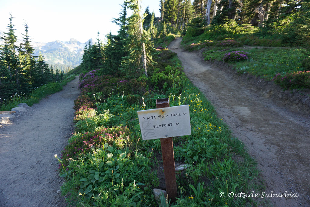
This main trail also provides access to Alta Vista, the Glacier Vista and other Paradise trails viewpoints. I had to scrabble a bit to get to the top of this viewpoint. The view was the same. I would personally skip it.
We found many snow patches at the higher elevations as you ascend the slopes of Mount Rainier. You can stop at Deadhorse creek trail or Alta Vista, or make the strenuous hike to Glacier Vista trail or Panorama Point.

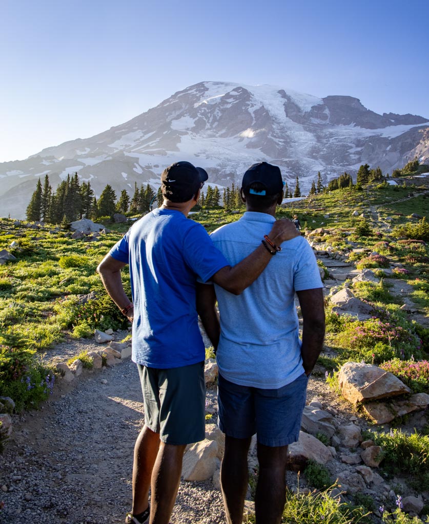
From Panorama Point, you can see spectacular views over the park, and on a clear day, you can see as far as Mount Hood in Oregon.
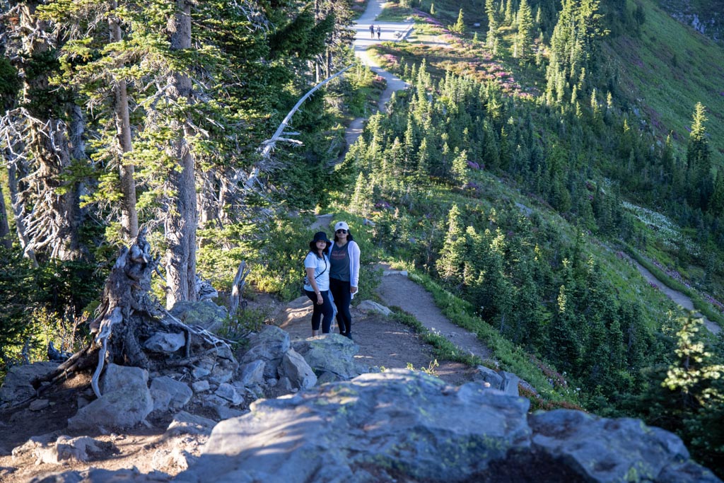
I stopped by rock with a killer view of Mt. Rainier, saving my energy for the steep descent back to the Paradise Visitor Center, while my friends made it to Glacier Vista point. The total Ascent for this hike was around 2000 feet, you are at 5,940-feet at Alta Vista.
This hike reminded me of the 5 lakes Matterhorn hike in Zermatt
Reflection Lakes
Hiking Distance: 6.2 miles
Trail Difficulty: Easy
Approx Time Needed: 3 to 5 hours
Trailhead: Reflection Lakes trailhead on the Stevens Canyon Highway
You can hike down to Reflection Lakes, from Paradise, or drive down. The roundtrip for the hike is 3 miles if you hike from Paradise. The easier option, if you are tired from all that hiking at Mt.Rainier is to drive from Paradise to the parking lot at trailhead on the Stevens Canyon Highway right next to Reflection Lakes.
The reason Reflection Lake is a must-see in Mt.Rainier is because of the beautiful photo opportunity. From the lakes Mount Rainier looms in the background, reflecting into the lake to create a reflection and mirror of itself. The water was quite murky and we were not able to see the reflection when we were there. Earlier in the day is probably better for this.
If the wildflower displays are not enough to make you heady, there’s the postcard view of Mount Rainier. It gets even better – when Mount Rainier is not obscured by clouds The Mountain casts its reflection in the lakes (hence, Reflection Lakes). Stroll along the lakeshore on the designated trail or venture further onto the Lakes Trail for different wildflower displays and views.
Camp Muir
Hiking Distance: 8 miles
Trail Difficulty: Strenuous
Approx Time Needed: 8 to 10 hours
Trailhead: Upper Paradise parking lot
Camp Muir is the closest you can get to the summit of Mount Rainier without a climbing permit. I spoke to someone who had done the climb and he mentioned it was tougher than other ones he had done. He didn’t summit, was a few feet short!
To get to Camp Muir, you will need to hike the Skyline Trail to the Pebble Creek Trail. From there, it is a steep ascent up the mountain through the snow. It is very challenging to hike and you must be pretty fit to attempt it. The total ascent is 4,800 feet and by the time you make it to Camp Muir, you will be at an elevation of 10,188 feet! Whew!! For serious hikers and climbers only!
Hiking trails in the Sunrise Area
Saving these hikes at Sunrise area of Mount Rainier National Park for the next trip 🙂
Sunrise Rim Trail, my Bucket list Mt. Rainier Hike
Located on the NE side of Mount Rainier at Sunrise, this rim trail is on my wishlist for another summer trip. With an elevation gain of only 800 feet and a total distance of 5.7 miles, The Sunrise Rim Trail is an alternate loop option to reach the stunning views at Burroughs Mountain. The trail is supposedly less traveled and offers panoramic vistas and wildflower meadows.
If you’re not interested in the full 5.7-mile loop, there is a 3-mile, kid-friendly stroll to Yakima Park and the Emmons Overlook.
Burroughs Mountain Trail
Hiking Distance: 6.3 miles
Trail Difficulty: Moderate to
Elevation Gain: 1,000 feet
Location: NE side of Mount Rainier at Sunrise
From Sunrise depart toward massive Tahoma, with the imposing Willis Wall constantly in front of you and Emmons Glacier which is Mount Rainier’s largest, at your side. The ascent to the final burrough takes you to 7,402 feet, where there it is nearly a lifeless environment. This point is also the highest point that is accessible by trail in Mount Rainier National Park.
See the other day hikes at Mt. Rainier National Park
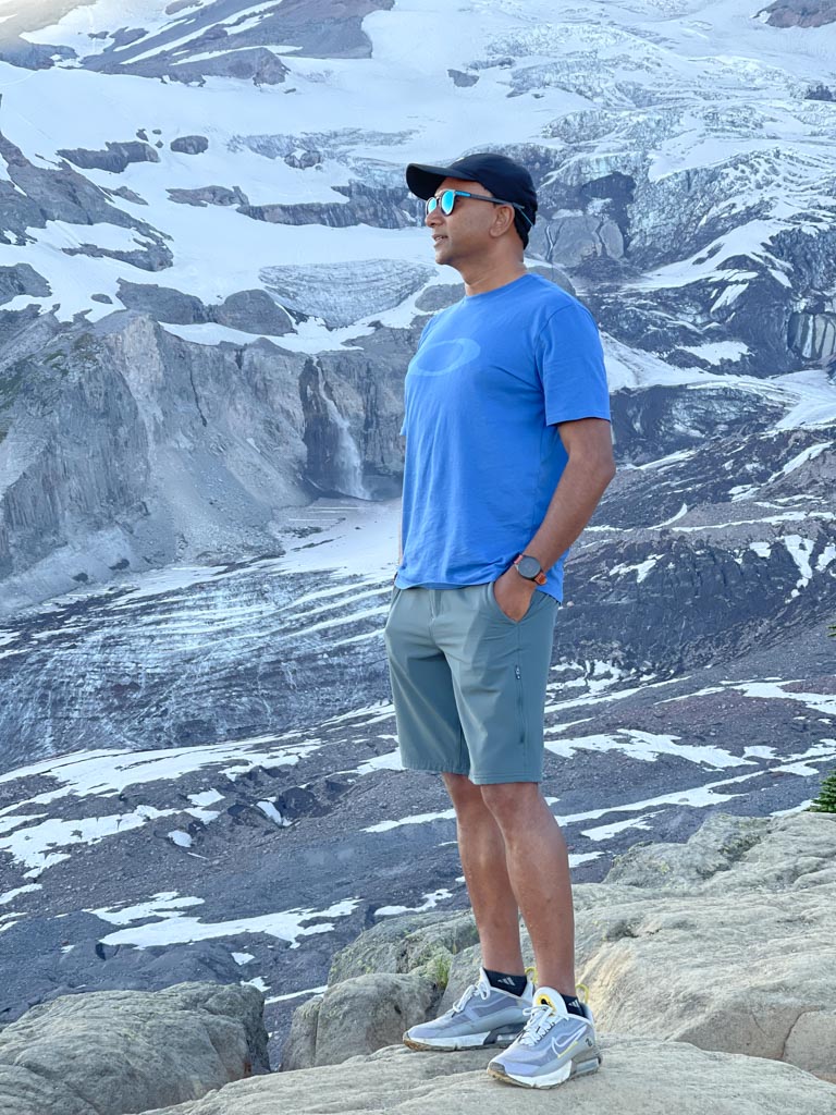
A few more photos from our hike at Mt. Rainier


Thanks for the photos Panneer
Tips for visiting Mt. Rainier NP
Paradise is the most popular place in Mount Rainier National Park.
Be prepared for a variety of terrain while hiking in Mt. Rainier Nationa Park, especially on the Skyline Trail. Wear sturdy boots, preferably hiking shoes. Bring water, snacks, and warm layers.
Protect and Preserve Meadows. In the heavily used Paradise, Sunrise, and Tipsoo Lake meadows, hikers are required by law to stay on trails. Hikers are asked to avoid fragile wildflower meadows, lakeshores, and stream banks throughout the park. Please choose a spot for photos or lunch stops with that in mind.
Do not feed wildlife to help Keep Wildlife Wild. Feeding wildlife invites aggressive animal behavior and may injure people and commonly results in wildlife death. Feeding birds artificially concentrates nest predators, harming young songbirds. Avoid it!
See this post if you need some help packing for a mountain adventure.
Get the America the Beautiful Pass
Mount Rainier has a Single Vehicle Entrance Fee of $30. If you have plans to visit multiple National Parks, it is worth it to purchase the America the Beautiful Pass. The annual park pass costs $80 and is valid for one year. You save money on park fees plus you will also get free admission to any other national park or federal recreation sites that you visit within 365 days of purchasing this pass.
You can purchase your pass online or at the national park that you visit. Click here to learn more.
I love summer in the mountains! The views are gorgeous, the air is crisp and pure! After a day in the mountains, you are sure to return with fresh air in your lungs and tons of memories and beautiful photos 🙂
PIN IT FOR LATER
CONNECT WITH US